Faculty Profile
Peter Sak
Professor of Geosciences (2004)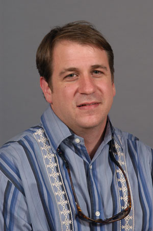
Contact Information
Kaufman Hall Kaufman Hall 138
717-245-1423
Bio
He specializes in describing and quantifying temporal and spatial variations in near surface deformation and landscape evolution. To document variability in regional scale deformation he integrates structural, geomorphic, and petrographic data sets. His current research projects involve field work along the Pacific coast of Costa Rica, in central Colorado, and Valley and Ridge of central PA.
Education
- B.A., Whitman College, 1995
- M.S., The Pennsylvania State University, 1999
- Ph.D., 2002
2026-2027 Academic Year
Fall 2026
GEOS 141 Earth's Hazards
This course examines natural processes such as earthquakes, volcanic eruptions, mass wasting events, and floods that have the potential to produce disastrous consequences for humans. All of these processes result from interactions between the atmosphere, biosphere, geosphere and hydrosphere directly or indirectly, which is the realm of earth sciences. Increasing global populations and increasingly interdependent national economies mean that few disasters are now only ‘local’. This course will use examples such as case studies of recent earthquakes and volcanic eruptions to examine how natural processes can be hazardous, and whether or not humans can anticipate and mitigate these kinds of hazards to prevent future disasters. Laboratory work will include analog experiments, field trips, and video analysis of historic disasters. Three hours classroom and three hours laboratory a week.
GEOS 500 Structural Geology
GEOS 560 Stu/Faculty Collaborative Rsch
Spring 2027
GEOS 204 Intro GIS Field Applications
Geographic Information Systems (GIS) is a powerful technology for managing, analyzing, and visualizing spatial data and geographically-referenced information. Using exclusively open-source software, this course provides a foundation of theoretical and applied skills in GIS technology with an emphasis on applications commonly employed in the field-based sciences. Students will learn to develop and use protocols for collecting spatially representative data in outdoor settings and then learn techniques for the manipulation, analysis, output and presentation of those data. The course will culminate in a final, independent project in which the students design and prepare a GIS analysis application of their own choosing. Three hours of classroom and three hours of laboratory per week. No prior GIS experience is needed.